
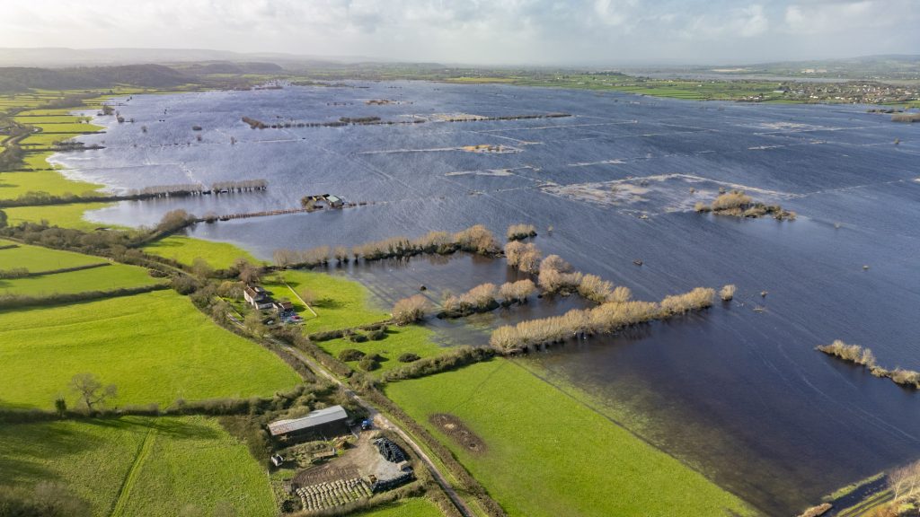
A collaborative approach to planning the future of our moors.
For the past two years, as part of the Environment Agency funded Lowland Agricultural Peat Water Discovery Pilot, FWAG South West, in partnership with Avon Wildlife Trust, has worked with over 27 farmers and landowners across 725 hectares on the North Somerset Levels and Moors.
This work has focused on developing and testing a new approach to land use planning at a landscape scale—Whole Moor Planning—designed to help farmers and landowners work together to shape the future of their shared environment. This work draws on FWAG South West’s experience of working closely with farm businesses across the region, combining practical farming knowledge with environmental expertise to support informed, locally relevant decision-making.

What is Whole Moor Planning?
Whole Moor Planning is a collaborative, farmer-led approach to managing land across an entire moor, rather than on a field-by-field or farm-by-farm basis.
It recognises that on the Levels & Moors:
- Water is managed across a connected system
- Peat soils function at a landscape scale
- Environmental and farming outcomes are interdependent
By bringing together farmers, landowners and partners within a single hydrological block (an area governed by the same water management infrastructure), Whole Moor Planning enables groups to:
- Develop a shared understanding of their landscape
- Identify common challenges and opportunities
- Agree priorities for future land use and water management

Why this approach is needed
The Somerset Levels and Moors face a unique combination of pressures:
- Peat degradation and carbon loss
- Flood risk and water level management challenges
- The need to maintain productive and viable farm businesses
- Biodiversity decline across fragmented habitats
These challenges cannot be effectively addressed in isolation. Decisions made on one farm can directly affect neighbouring land and the wider moor.
Whole Moor Planning provides a way to coordinate decisions across the landscape, suitable for that particular area and help to balance environmental outcomes with the practical realities of farming.
The Whole Moor Planning process
At the heart of this approach is a structured, consensus-building process led by farmers and landowners, facilitated by FWAGSW and its advisers
While each moor will adapt the process to suit local needs, the key stages are:
- Forming a Moor Association and subcommittee – Farmers and landowners come together as a group and appoint a subcommittee to guide the process and coordinate activity.
- Developing an initial vision – The subcommittee works with available evidence and expertise to explore what may be possible across the moor, considering:
- Water management constraints
- Peat condition
- Farming systems
- Biodiversity opportunities
This is often supported by mapping, SWOT analysis and technical input.
- Sharing opportunities with the wider group – Initial ideas and potential opportunities are presented to all Moor Association members to start discussion.
- Gathering feedback – Feedback is collected through meetings and conversations, ensuring all members can shape the direction of the plan.
- Drafting and refining proposals – A first-pass proposal is developed and shared ahead of further discussion, allowing time for consideration and input.
- Building consensus – Through an iterative process of discussion, feedback and refinement, proposals are amended until agreement is reached.
- Agreeing a Whole Moor Plan – The final outcome is a shared plan that reflects the priorities of the group and works for the moor as a whole.
Importantly, while external experts may inform the process, farmers and landowners retain ownership—ensuring the final vision is practical, locally relevant, and supported by those delivering it.
The process has been led and supported by FWAG South West’s team of specialist environmental advisers and experienced farm liaison officers, who provide technical insight, facilitate discussions, and help guide groups through each stage while ensuring the approach remains farmer-led.

Somerset Moor Futures in practice
Through Somerset Moor Futures, this model has been tested and refined in North Somerset, working directly with farmers and landowners to apply the process in a real-world setting.
The project has:
- Supported collaboration across 725 hectares
- Enabled shared understanding of landscape-scale challenges
- Built confidence in working collectively
- Demonstrated how consensus can be achieved across multiple businesses

A model for future landscape recovery
This approach proved vital in building agreement for the Greater Sedgemoor Landscape Recovery project, showing how a whole moor plan can support larger-scale environmental delivery.
It provides a replicable model for other moors and lowland peat landscapes, helping farmer groups to:
- Access future funding opportunities
- Align with emerging environmental schemes
- Deliver coordinated action at scale

Supporting better decisions, together
Whole Moor Planning is ultimately about enabling better, more joined-up decision-making—grounded in local knowledge, shaped by those who manage the land, and supported by the right evidence and expertise.
As pressures on peatland landscapes continue to grow, approaches like this will be essential in creating resilient, productive, and environmentally sustainable futures for the Somerset Levels and beyond. Different landscapes demand different approaches, and the insight of those who truly understand local conditions that should guide management decisions—because informed, place-specific commitments are ultimately what will drive the most meaningful and lasting positive impact.
All photos by Bill Bradshaw.