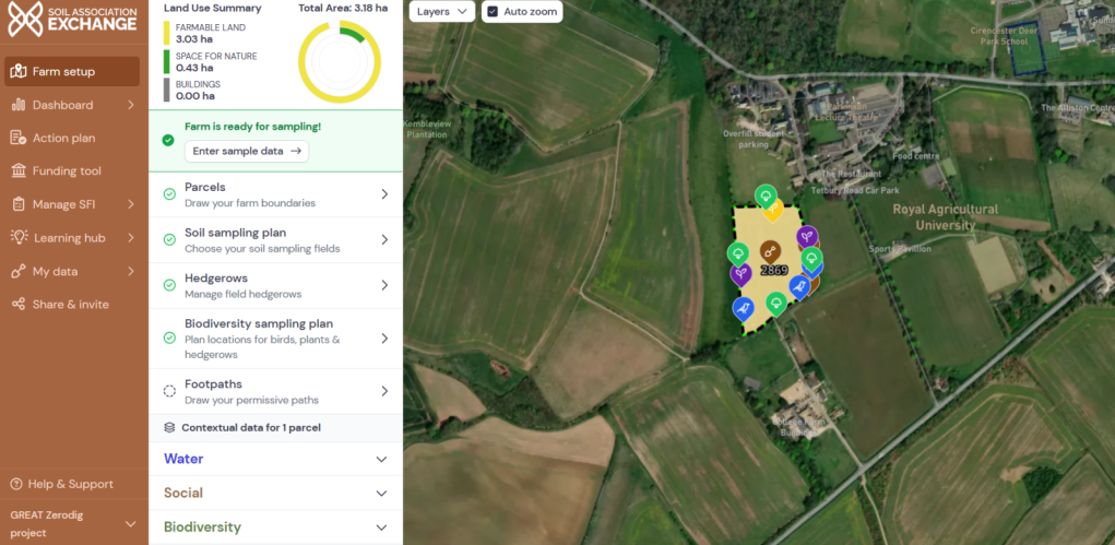
We are using the newly launched Soil Association Exchange (SAX) to benchmark four landholdings throughout the Kemble-Waterhay catchment, specifically, Sapperton Wilder, Coates Farm, our GREAT Zerodig project on College field, and the Bathurst Estate.
The Soil Association Exchange has adopted a whole farm approach to recording data for its metrics, focussing on biodiversity, soils, animal welfare, carbon, water and social criteria. This data collection exercise is being provided at no cost to the farms in question, and ongoing feedback is also being provided to the development team at the Soil Association, to tailor and refine the Exchange further.
For more information about Soil Association Exchange please click here https://www.soilassociationexchange.com/for-farmers
We will be carrying out on-farm benchmarking of 4 landholdings via the Soil Association Exchange, by conducting field surveys for the exchange’s full range of 42 different metrics. These metrics will be compared with data from other users of the Soil Association Exchange, to determine the current value of the selected landholdings, in relation to their financial performance and environmental credentials.
Collecting farm data for these metrics involves soil surveys using the VESS method (Visual Evaluation of Soil Structure), earthworm surveys and hedgerow condition assessments (to satisfy monitoring requirements for the Sustainable Farming incentive actions CHRW 1-3), in addition to biodiversity benchmarking. These surveys are subsequently categorised into the following themes:
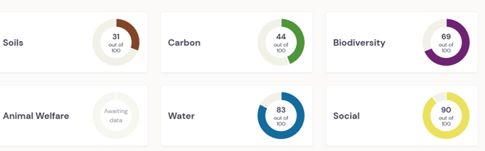
These themes are continually updated as new data is added to the SAX platform, ensuring that farms obtain a comprehensive, live picture of their agricultural enterprise.
The SAX platform also interfaces with the Sustainable Farming Incentive and other funding programmes, suggesting applicable actions and payment rates, along with other key information.
Collectively we aim to have a comprehensive platform which brings the full range of metrics into an accessible format, that is also simple in collecting whole farm data and is vital for benchmarking these landholdings in terms of their biodiversity enhancements. These enhancements can include providing wildflower margins, gapping up hedgerows or using natural flood management techniques (creating ponds/leaky dams etc) to manage water flow. Further data could then be gathered in the future to allow each landholding to measure their improvements against their original benchmark.
In addition we are working with the developers to identify amendments and updates to the platform by using the software in-field across the four landholdings identified for this project. We can act as a point of connection between the software developers and the farmers that they hope to engage with, making sure that each party benefits fully from their working relationship.
Project lead/contact is Edward Bonn – email: edward.bonn@fwagsw.org.uk
Thames Water Catchment Fund